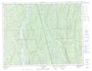
Maps showing Rivière Saint-Paul, Lac-Walker; Sept-Rivières, Quebec
Rivière Saint-Paul is a River located in Lac-Walker; Sept-Rivières, Quebec.
- Latitude: 50° 24' 27'' North (decimal: 50.4075211)
- Longitude: 67° 52' 51'' West (decimal: -67.8808732)
- Topography Feature Category: River
- Geographical Feature: Ruisseau
- Canadian Province/Territory: Quebec
- Location: Lac-Walker; Sept-Rivières
- Atlas of Canada Locator Map: Rivière Saint-Paul
- GPS Coordinate Locator Map: Rivière Saint-Paul Lat/Long
Rivière Saint-Paul NTS Map Sheets