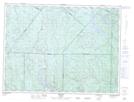
Maps showing La Petite Rivière, Lalemant; Le Fjord-du-Saguenay, Quebec
La Petite Rivière is a River located in Lalemant; Le Fjord-du-Saguenay, Quebec.
- Latitude: 48° 5' 25'' North (decimal: 48.0903090)
- Longitude: 70° 38' 8'' West (decimal: -70.6356334)
- Topography Feature Category: River
- Geographical Feature: Ruisseau
- Canadian Province/Territory: Quebec
- Location: Lalemant; Le Fjord-du-Saguenay
- Atlas of Canada Locator Map: La Petite Rivière
- GPS Coordinate Locator Map: La Petite Rivière Lat/Long