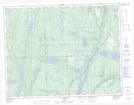
Maps showing La Fourche, Lac-Walker; Sept-Rivières, Quebec
La Fourche is a Unincorporated area located in Lac-Walker; Sept-Rivières, Quebec.
- Latitude: 50° 22' 43'' North (decimal: 50.3786319)
- Longitude: 66° 58' 34'' West (decimal: -66.9762456)
- Topography Feature Category: Unincorporated area
- Geographical Feature: Lieu-dit
- Canadian Province/Territory: Quebec
- Location: Lac-Walker; Sept-Rivières
- Atlas of Canada Locator Map: La Fourche
- GPS Coordinate Locator Map: La Fourche Lat/Long
La Fourche NTS Map Sheets