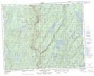
Maps showing Saut Blanc, Rivière-Nipissis; Sept-Rivières, Quebec
Saut Blanc is a Falls located in Rivière-Nipissis; Sept-Rivières, Quebec.
- Latitude: 51° 15' 8'' North (decimal: 51.2522771)
- Longitude: 66° 17' 33'' West (decimal: -66.2924346)
- Topography Feature Category: Falls
- Geographical Feature: Chute
- Canadian Province/Territory: Quebec
- Location: Rivière-Nipissis; Sept-Rivières
- Atlas of Canada Locator Map: Saut Blanc
- GPS Coordinate Locator Map: Saut Blanc Lat/Long
Saut Blanc NTS Map Sheets