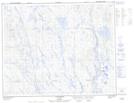
Maps showing Rivière Cassée, Rivière-Mouchalagane; Caniapiscau, Quebec
Rivière Cassée is a River located in Rivière-Mouchalagane; Caniapiscau, Quebec.
- Latitude: 52° 22' 54'' North (decimal: 52.3817352)
- Longitude: 67° 53' 8'' West (decimal: -67.8854865)
- Topography Feature Category: River
- Geographical Feature: Rivière
- Canadian Province/Territory: Quebec
- Location: Rivière-Mouchalagane; Caniapiscau
- Atlas of Canada Locator Map: Rivière Cassée
- GPS Coordinate Locator Map: Rivière Cassée Lat/Long
Rivière Cassée NTS Map Sheets