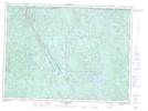
Maps showing Barrage Talbot, Lac-Pikauba; Charlevoix, Quebec
Barrage Talbot is a Hydraulic construction located in Lac-Pikauba; Charlevoix, Quebec.
- Latitude: 47° 53' 19'' North (decimal: 47.8886487)
- Longitude: 71° 15' 9'' West (decimal: -71.2525912)
- Topography Feature Category: Hydraulic construction
- Geographical Feature: Barrage
- Canadian Province/Territory: Quebec
- Location: Lac-Pikauba; Charlevoix
- Atlas of Canada Locator Map: Barrage Talbot
- GPS Coordinate Locator Map: Barrage Talbot Lat/Long
Barrage Talbot NTS Map Sheets