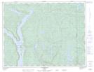
Maps showing Le Pouce, Rivière-aux-Outardes; Manicouagan, Quebec
Le Pouce is a Bay located in Rivière-aux-Outardes; Manicouagan, Quebec.
- Latitude: 49° 35' 23'' North (decimal: 49.5897733)
- Longitude: 68° 18' 33'' West (decimal: -68.3091980)
- Topography Feature Category: Bay
- Geographical Feature: Baie
- Canadian Province/Territory: Quebec
- Location: Rivière-aux-Outardes; Manicouagan
- Atlas of Canada Locator Map: Le Pouce
- GPS Coordinate Locator Map: Le Pouce Lat/Long
Le Pouce NTS Map Sheets