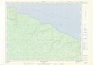
Maps showing Phare de Pointe-Carleton, L'Île-d'Anticosti; Minganie, Quebec
Phare de Pointe-Carleton is a Marine navigation feature located in L'Île-d'Anticosti; Minganie, Quebec.
- Latitude: 49° 43' 52'' North (decimal: 49.7311798)
- Longitude: 62° 56' 34'' West (decimal: -62.9429030)
- Topography Feature Category: Marine navigation feature
- Geographical Feature: Phare
- Canadian Province/Territory: Quebec
- Location: L'Île-d'Anticosti; Minganie
- Atlas of Canada Locator Map: Phare de Pointe-Carleton
- GPS Coordinate Locator Map: Phare de Pointe-Carleton Lat/Long
Phare de Pointe-Carleton NTS Map Sheets