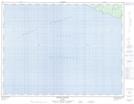
Maps showing Camping Chicotte, L'Île-d'Anticosti; Minganie, Quebec
Camping Chicotte is a Miscellaneous campsite located in L'Île-d'Anticosti; Minganie, Quebec.
- Latitude: 49° 14' 31'' North (decimal: 49.2420100)
- Longitude: 63° 6' 57'' West (decimal: -63.1159617)
- Topography Feature Category: Miscellaneous campsite
- Geographical Feature: Terrain de camping
- Canadian Province/Territory: Quebec
- Location: L'Île-d'Anticosti; Minganie
- Atlas of Canada Locator Map: Camping Chicotte
- GPS Coordinate Locator Map: Camping Chicotte Lat/Long
Camping Chicotte NTS Map Sheets