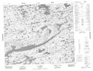
Maps showing Centrale Laforge-1, Baie-James; Jamésie, Quebec
Centrale Laforge-1 is a Hydraulic construction located in Baie-James; Jamésie, Quebec.
- Latitude: 54° 10' 14'' North (decimal: 54.1706826)
- Longitude: 72° 36' 53'' West (decimal: -72.6148083)
- Topography Feature Category: Hydraulic construction
- Geographical Feature: Centrale hydroélectrique
- Canadian Province/Territory: Quebec
- Location: Baie-James; Jamésie
- Atlas of Canada Locator Map: Centrale Laforge-1
- GPS Coordinate Locator Map: Centrale Laforge-1 Lat/Long
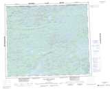
Centrale Laforge-1 NTS Map Sheets