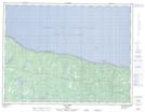
Maps showing Lac-Geneviève, L'Île-d'Anticosti; Minganie, Quebec
Lac-Geneviève is a Miscellaneous campsite located in L'Île-d'Anticosti; Minganie, Quebec.
- Latitude: 49° 50' 58'' North (decimal: 49.8495078)
- Longitude: 63° 58' 58'' West (decimal: -63.9826596)
- Topography Feature Category: Miscellaneous campsite
- Geographical Feature: Camp sportif
- Canadian Province/Territory: Quebec
- Location: L'Île-d'Anticosti; Minganie
- Atlas of Canada Locator Map: Lac-Geneviève
- GPS Coordinate Locator Map: Lac-Geneviève Lat/Long
Lac-Geneviève NTS Map Sheets