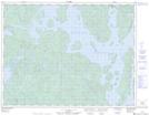
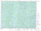
Maps showing Lac à Rick, Rivière-aux-Outardes; Manicouagan, Quebec
Lac à Rick is a Lake located in Rivière-aux-Outardes; Manicouagan, Quebec.
- Latitude: 50° 13' 7'' North (decimal: 50.2186600)
- Longitude: 69° 6' 1'' West (decimal: -69.1001638)
- Topography Feature Category: Lake
- Geographical Feature: Lac
- Canadian Province/Territory: Quebec
- Location: Rivière-aux-Outardes; Manicouagan
- Atlas of Canada Locator Map: Lac à Rick
- GPS Coordinate Locator Map: Lac à Rick Lat/Long
Lac à Rick NTS Map Sheets