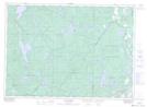
Maps showing Ruisseau Egan, Montcerf-Lytton; La Vallée-de-la-Gatineau, Quebec
Ruisseau Egan is a River located in Montcerf-Lytton; La Vallée-de-la-Gatineau, Quebec.
- Latitude: 46° 27' 52'' North (decimal: 46.4645001)
- Longitude: 76° 2' 49'' West (decimal: -76.0468975)
- Topography Feature Category: River
- Geographical Feature: Ruisseau
- Canadian Province/Territory: Quebec
- Location: Montcerf-Lytton; La Vallée-de-la-Gatineau
- Atlas of Canada Locator Map: Ruisseau Egan
- GPS Coordinate Locator Map: Ruisseau Egan Lat/Long
Ruisseau Egan NTS Map Sheets