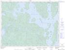
Maps showing Le Triangle-des-Outardes, Rivière-aux-Outardes; Manicouagan, Quebec
Le Triangle-des-Outardes is a Unincorporated area located in Rivière-aux-Outardes; Manicouagan, Quebec.
- Latitude: 50° 8' 35'' North (decimal: 50.1430992)
- Longitude: 69° 4' 54'' West (decimal: -69.0815635)
- Topography Feature Category: Unincorporated area
- Geographical Feature: Lieu-dit
- Canadian Province/Territory: Quebec
- Location: Rivière-aux-Outardes; Manicouagan
- Atlas of Canada Locator Map: Le Triangle-des-Outardes
- GPS Coordinate Locator Map: Le Triangle-des-Outardes Lat/Long