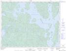
Maps showing Baie du Grand Chenal, Rivière-aux-Outardes; Manicouagan, Quebec
Baie du Grand Chenal is a Bay located in Rivière-aux-Outardes; Manicouagan, Quebec.
- Latitude: 50° 3' 53'' North (decimal: 50.0647580)
- Longitude: 69° 0' 44'' West (decimal: -69.0121244)
- Topography Feature Category: Bay
- Geographical Feature: Baie
- Canadian Province/Territory: Quebec
- Location: Rivière-aux-Outardes; Manicouagan
- Atlas of Canada Locator Map: Baie du Grand Chenal
- GPS Coordinate Locator Map: Baie du Grand Chenal Lat/Long