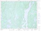
Maps showing Baie de l'Accueil, Rivière-aux-Outardes; Manicouagan, Quebec
Baie de l'Accueil is a Bay located in Rivière-aux-Outardes; Manicouagan, Quebec.
- Latitude: 50° 5' 13'' North (decimal: 50.0869799)
- Longitude: 68° 59' 2'' West (decimal: -68.9837892)
- Topography Feature Category: Bay
- Geographical Feature: Baie
- Canadian Province/Territory: Quebec
- Location: Rivière-aux-Outardes; Manicouagan
- Atlas of Canada Locator Map: Baie de l'Accueil
- GPS Coordinate Locator Map: Baie de l'Accueil Lat/Long
Baie de l'Accueil NTS Map Sheets