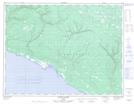
Maps showing Tour-Chicotte, L'Île-d'Anticosti; Minganie, Quebec
Tour-Chicotte is a Unincorporated area located in L'Île-d'Anticosti; Minganie, Quebec.
- Latitude: 49° 26' 20'' North (decimal: 49.4389579)
- Longitude: 63° 6' 22'' West (decimal: -63.1062422)
- Topography Feature Category: Unincorporated area
- Geographical Feature: Lieu-dit
- Canadian Province/Territory: Quebec
- Location: L'Île-d'Anticosti; Minganie
- Atlas of Canada Locator Map: Tour-Chicotte
- GPS Coordinate Locator Map: Tour-Chicotte Lat/Long
Tour-Chicotte NTS Map Sheets