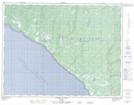
Maps showing Petit ruisseau au Cheval, L'Île-d'Anticosti; Minganie, Quebec
Petit ruisseau au Cheval is a River located in L'Île-d'Anticosti; Minganie, Quebec.
- Latitude: 49° 36' 48'' North (decimal: 49.6134010)
- Longitude: 63° 33' 3'' West (decimal: -63.5506983)
- Topography Feature Category: River
- Geographical Feature: Ruisseau
- Canadian Province/Territory: Quebec
- Location: L'Île-d'Anticosti; Minganie
- Atlas of Canada Locator Map: Petit ruisseau au Cheval
- GPS Coordinate Locator Map: Petit ruisseau au Cheval Lat/Long
Petit ruisseau au Cheval NTS Map Sheets