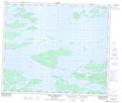
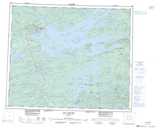
Maps showing Île Janjandashi, Baie-James; Jamésie, Quebec
Île Janjandashi is a Island located in Baie-James; Jamésie, Quebec.
- Latitude: 53° 35' 49'' North (decimal: 53.5970628)
- Longitude: 77° 16' 46'' West (decimal: -77.2794714)
- Topography Feature Category: Island
- Geographical Feature: Île / Ile
- Canadian Province/Territory: Quebec
- Location: Baie-James; Jamésie
- Atlas of Canada Locator Map: Île Janjandashi
- GPS Coordinate Locator Map: Île Janjandashi Lat/Long
Île Janjandashi NTS Map Sheets