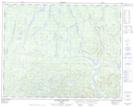
Maps showing Mont du Gros Chat, Rivière-aux-Outardes; Manicouagan, Quebec
Mont du Gros Chat is a Mountain located in Rivière-aux-Outardes; Manicouagan, Quebec.
- Latitude: 51° 7' 41'' North (decimal: 51.1281135)
- Longitude: 69° 39' 14'' West (decimal: -69.6539195)
- Topography Feature Category: Mountain
- Geographical Feature: Mont
- Canadian Province/Territory: Quebec
- Location: Rivière-aux-Outardes; Manicouagan
- Atlas of Canada Locator Map: Mont du Gros Chat
- GPS Coordinate Locator Map: Mont du Gros Chat Lat/Long
Mont du Gros Chat NTS Map Sheets