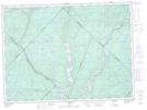
Maps showing Centrale Beaumont, La Tuque; Le Haut-Saint-Maurice, Quebec
Centrale Beaumont is a Hydraulic construction located in La Tuque; Le Haut-Saint-Maurice, Quebec.
- Latitude: 47° 33' 20'' North (decimal: 47.5555928)
- Longitude: 72° 50' 10'' West (decimal: -72.8362166)
- Topography Feature Category: Hydraulic construction
- Geographical Feature: Centrale hydroélectrique
- Canadian Province/Territory: Quebec
- Location: La Tuque; Le Haut-Saint-Maurice
- Atlas of Canada Locator Map: Centrale Beaumont
- GPS Coordinate Locator Map: Centrale Beaumont Lat/Long