Maps showing Le Château-Menier, L'Île-d'Anticosti; Minganie, Quebec
Le Château-Menier is a Unincorporated area located in L'Île-d'Anticosti; Minganie, Quebec.
- Latitude: 49° 49' 30'' North (decimal: 49.825)
- Longitude: 64° 22' 5'' West (decimal: -64.3680556)
- Topography Feature Category: Unincorporated area
- Geographical Feature: Lieu-dit
- Canadian Province/Territory: Quebec
- Location: L'Île-d'Anticosti; Minganie
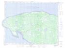
- Atlas of Canada Locator Map: Le Château-Menier
- GPS Coordinate Locator Map: Le Château-Menier Lat/Long
Le Château-Menier NTS Map Sheets