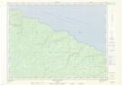
Maps showing Grotte Kateri, L'Île-d'Anticosti; Minganie, Quebec
Grotte Kateri is a Cave located in L'Île-d'Anticosti; Minganie, Quebec.
- Latitude: 49° 38' 12'' North (decimal: 49.6366999)
- Longitude: 62° 54' 20'' West (decimal: -62.9055999)
- Topography Feature Category: Cave
- Geographical Feature: Grotte
- Canadian Province/Territory: Quebec
- Location: L'Île-d'Anticosti; Minganie
- Atlas of Canada Locator Map: Grotte Kateri
- GPS Coordinate Locator Map: Grotte Kateri Lat/Long
Grotte Kateri NTS Map Sheets