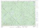
Maps showing Barrage Charland, Lac-Matawin; Matawinie, Quebec
Barrage Charland is a Hydraulic construction located in Lac-Matawin; Matawinie, Quebec.
- Latitude: 46° 50' 39'' North (decimal: 46.8442101)
- Longitude: 74° 8' 14'' West (decimal: -74.1370982)
- Topography Feature Category: Hydraulic construction
- Geographical Feature: Barrage
- Canadian Province/Territory: Quebec
- Location: Lac-Matawin; Matawinie
- Atlas of Canada Locator Map: Barrage Charland
- GPS Coordinate Locator Map: Barrage Charland Lat/Long
Barrage Charland NTS Map Sheets