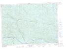
Maps showing Barrage Johnson, Rivière-Kipawa; Témiscamingue, Quebec
Barrage Johnson is a Hydraulic construction located in Rivière-Kipawa; Témiscamingue, Quebec.
- Latitude: 46° 19' 19'' North (decimal: 46.3220028)
- Longitude: 78° 19' 44'' West (decimal: -78.3289381)
- Topography Feature Category: Hydraulic construction
- Geographical Feature: Barrage
- Canadian Province/Territory: Quebec
- Location: Rivière-Kipawa; Témiscamingue
- Atlas of Canada Locator Map: Barrage Johnson
- GPS Coordinate Locator Map: Barrage Johnson Lat/Long
Barrage Johnson NTS Map Sheets