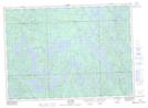
Maps showing Barrage Bleu, Rivière-Kipawa; Témiscamingue, Quebec
Barrage Bleu is a Hydraulic construction located in Rivière-Kipawa; Témiscamingue, Quebec.
- Latitude: 46° 40' 51'' North (decimal: 46.6808901)
- Longitude: 78° 25' 50'' West (decimal: -78.4306090)
- Topography Feature Category: Hydraulic construction
- Geographical Feature: Barrage
- Canadian Province/Territory: Quebec
- Location: Rivière-Kipawa; Témiscamingue
- Atlas of Canada Locator Map: Barrage Bleu
- GPS Coordinate Locator Map: Barrage Bleu Lat/Long