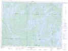
Maps showing Barrage Camatose-2, Lac-Pythonga; La Vallée-de-la-Gatineau, Quebec
Barrage Camatose-2 is a Hydraulic construction located in Lac-Pythonga; La Vallée-de-la-Gatineau, Quebec.
- Latitude: 47° 19' 15'' North (decimal: 47.3209103)
- Longitude: 76° 56' 16'' West (decimal: -76.9377507)
- Topography Feature Category: Hydraulic construction
- Geographical Feature: Barrage
- Canadian Province/Territory: Quebec
- Location: Lac-Pythonga; La Vallée-de-la-Gatineau
- Atlas of Canada Locator Map: Barrage Camatose-2
- GPS Coordinate Locator Map: Barrage Camatose-2 Lat/Long
Barrage Camatose-2 NTS Map Sheets