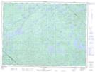
Maps showing Barrage Wahoo, Lac-Lenôtre; La Vallée-de-la-Gatineau, Quebec
Barrage Wahoo is a Hydraulic construction located in Lac-Lenôtre; La Vallée-de-la-Gatineau, Quebec.
- Latitude: 47° 30' 2'' North (decimal: 47.5006282)
- Longitude: 76° 6' 46'' West (decimal: -76.1127085)
- Topography Feature Category: Hydraulic construction
- Geographical Feature: Barrage
- Canadian Province/Territory: Quebec
- Location: Lac-Lenôtre; La Vallée-de-la-Gatineau
- Atlas of Canada Locator Map: Barrage Wahoo
- GPS Coordinate Locator Map: Barrage Wahoo Lat/Long
Barrage Wahoo NTS Map Sheets