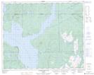
Maps showing Ruisseau du Huard, Rivière-Mouchalagane; Caniapiscau, Quebec
Ruisseau du Huard is a River located in Rivière-Mouchalagane; Caniapiscau, Quebec.
- Latitude: 51° 34' 9'' North (decimal: 51.5692103)
- Longitude: 68° 8' 3'' West (decimal: -68.1341409)
- Topography Feature Category: River
- Geographical Feature: Ruisseau
- Canadian Province/Territory: Quebec
- Location: Rivière-Mouchalagane; Caniapiscau
- Atlas of Canada Locator Map: Ruisseau du Huard
- GPS Coordinate Locator Map: Ruisseau du Huard Lat/Long
Ruisseau du Huard NTS Map Sheets