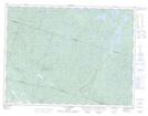
Maps showing Digue Vachon, Mont-Valin; Le Fjord-du-Saguenay, Quebec
Digue Vachon is a Hydraulic construction located in Mont-Valin; Le Fjord-du-Saguenay, Quebec.
- Latitude: 48° 37' 57'' North (decimal: 48.6325372)
- Longitude: 70° 39' 12'' West (decimal: -70.6534039)
- Topography Feature Category: Hydraulic construction
- Geographical Feature: Digue
- Canadian Province/Territory: Quebec
- Location: Mont-Valin; Le Fjord-du-Saguenay
- Atlas of Canada Locator Map: Digue Vachon
- GPS Coordinate Locator Map: Digue Vachon Lat/Long
Digue Vachon NTS Map Sheets