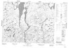
Maps showing Évacuateur Bonnard, Mont-Valin; Le Fjord-du-Saguenay, Quebec
Évacuateur Bonnard is a Miscellaneous located in Mont-Valin; Le Fjord-du-Saguenay, Quebec.
- Latitude: 50° 43' 18'' North (decimal: 50.7217472)
- Longitude: 71° 2' 10'' West (decimal: -71.0361742)
- Topography Feature Category: Miscellaneous
- Geographical Feature: Unclassified
- Canadian Province/Territory: Quebec
- Location: Mont-Valin; Le Fjord-du-Saguenay
- Atlas of Canada Locator Map: Évacuateur Bonnard
- GPS Coordinate Locator Map: Évacuateur Bonnard Lat/Long
Évacuateur Bonnard NTS Map Sheets