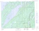
Maps showing Île Michel-Laplante, Baie-James; Jamésie, Quebec
Île Michel-Laplante is a Island located in Baie-James; Jamésie, Quebec.
- Latitude: 50° 50' 3'' North (decimal: 50.8342415)
- Longitude: 73° 24' 39'' West (decimal: -73.4106979)
- Topography Feature Category: Island
- Geographical Feature: Île / Ile
- Canadian Province/Territory: Quebec
- Location: Baie-James; Jamésie
- Atlas of Canada Locator Map: Île Michel-Laplante
- GPS Coordinate Locator Map: Île Michel-Laplante Lat/Long
Île Michel-Laplante NTS Map Sheets