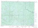
Maps showing Barrage Sten, Lac-Pythonga; La Vallée-de-la-Gatineau, Quebec
Barrage Sten is a Hydraulic construction located in Lac-Pythonga; La Vallée-de-la-Gatineau, Quebec.
- Latitude: 46° 51' 3'' North (decimal: 46.8508944)
- Longitude: 76° 15' 16'' West (decimal: -76.2543962)
- Topography Feature Category: Hydraulic construction
- Geographical Feature: Barrage
- Canadian Province/Territory: Quebec
- Location: Lac-Pythonga; La Vallée-de-la-Gatineau
- Atlas of Canada Locator Map: Barrage Sten
- GPS Coordinate Locator Map: Barrage Sten Lat/Long
Barrage Sten NTS Map Sheets