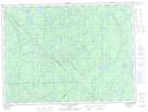
Maps showing Barrage Nastapolk, La Tuque; Le Haut-Saint-Maurice, Quebec
Barrage Nastapolk is a Hydraulic construction located in La Tuque; Le Haut-Saint-Maurice, Quebec.
- Latitude: 48° 5' 12'' North (decimal: 48.0867169)
- Longitude: 73° 21' 37'' West (decimal: -73.3603938)
- Topography Feature Category: Hydraulic construction
- Geographical Feature: Barrage
- Canadian Province/Territory: Quebec
- Location: La Tuque; Le Haut-Saint-Maurice
- Atlas of Canada Locator Map: Barrage Nastapolk
- GPS Coordinate Locator Map: Barrage Nastapolk Lat/Long
Barrage Nastapolk NTS Map Sheets