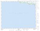
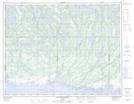
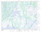
Maps showing Watshishou Bird Sanctuary, ;, Quebec
Watshishou Bird Sanctuary is a Conservation area located in ;, Quebec.
- Latitude: 50° 15' 30'' North (decimal: 50.2583333)
- Longitude: 62° 29' 45'' West (decimal: -62.4958333)
- Topography Feature Category: Conservation area
- Geographical Feature: Migratory Bird Sanctuary
- Canadian Province/Territory: Quebec
- Location: ;
- Atlas of Canada Locator Map: Watshishou Bird Sanctuary
- GPS Coordinate Locator Map: Watshishou Bird Sanctuary Lat/Long
Watshishou Bird Sanctuary NTS Map Sheets