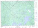
Maps showing Île aux Goélands, La Tuque; La Tuque, Quebec
Île aux Goélands is a Island located in La Tuque; La Tuque, Quebec.
- Latitude: 47° 33' 16'' North (decimal: 47.5544443)
- Longitude: 74° 7' 15'' West (decimal: -74.1208333)
- Topography Feature Category: Island
- Geographical Feature: Île / Ile
- Canadian Province/Territory: Quebec
- Location: La Tuque; La Tuque
- Atlas of Canada Locator Map: Île aux Goélands
- GPS Coordinate Locator Map: Île aux Goélands Lat/Long
Île aux Goélands NTS Map Sheets