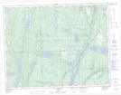
Maps showing Île du Vingt-Quatre, Lac-Walker; Sept-Rivières, Quebec
Île du Vingt-Quatre is a Island located in Lac-Walker; Sept-Rivières, Quebec.
- Latitude: 50° 29' 55'' North (decimal: 50.4986111)
- Longitude: 66° 33' 50'' West (decimal: -66.5638888)
- Topography Feature Category: Island
- Geographical Feature: Île / Ile
- Canadian Province/Territory: Quebec
- Location: Lac-Walker; Sept-Rivières
- Atlas of Canada Locator Map: Île du Vingt-Quatre
- GPS Coordinate Locator Map: Île du Vingt-Quatre Lat/Long
Île du Vingt-Quatre NTS Map Sheets