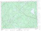
Maps showing Baie Bud, La Tuque; La Tuque, Quebec
Baie Bud is a Bay located in La Tuque; La Tuque, Quebec.
- Latitude: 47° 25' 50'' North (decimal: 47.4305555)
- Longitude: 73° 18' 24'' West (decimal: -73.3066666)
- Topography Feature Category: Bay
- Geographical Feature: Baie
- Canadian Province/Territory: Quebec
- Location: La Tuque; La Tuque
- Atlas of Canada Locator Map: Baie Bud
- GPS Coordinate Locator Map: Baie Bud Lat/Long
Baie Bud NTS Map Sheets