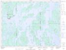
Maps showing Cap du Camp Vert, La Tuque; La Tuque, Quebec
Cap du Camp Vert is a Cape located in La Tuque; La Tuque, Quebec.
- Latitude: 48° 31' 45'' North (decimal: 48.5291666)
- Longitude: 74° 52' 45'' West (decimal: -74.8791666)
- Topography Feature Category: Cape
- Geographical Feature: Pointe
- Canadian Province/Territory: Quebec
- Location: La Tuque; La Tuque
- Atlas of Canada Locator Map: Cap du Camp Vert
- GPS Coordinate Locator Map: Cap du Camp Vert Lat/Long
Cap du Camp Vert NTS Map Sheets