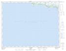
Maps showing Pointe de Terre à Caye Noire, Aguanish; Minganie, Quebec
Pointe de Terre à Caye Noire is a Cape located in Aguanish; Minganie, Quebec.
- Latitude: 50° 13' 51'' North (decimal: 50.2308333)
- Longitude: 62° 8' 18'' West (decimal: -62.1383333)
- Topography Feature Category: Cape
- Geographical Feature: Pointe
- Canadian Province/Territory: Quebec
- Location: Aguanish; Minganie
- Atlas of Canada Locator Map: Pointe de Terre à Caye Noire
- GPS Coordinate Locator Map: Pointe de Terre à Caye Noire Lat/Long
Pointe de Terre à Caye Noire NTS Map Sheets