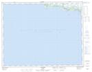
Maps showing Anse des Gallant, Aguanish; Minganie, Quebec
Anse des Gallant is a Bay located in Aguanish; Minganie, Quebec.
- Latitude: 50° 13' 15'' North (decimal: 50.2208333)
- Longitude: 62° 5' 6'' West (decimal: -62.085)
- Topography Feature Category: Bay
- Geographical Feature: Anse
- Canadian Province/Territory: Quebec
- Location: Aguanish; Minganie
- Atlas of Canada Locator Map: Anse des Gallant
- GPS Coordinate Locator Map: Anse des Gallant Lat/Long
Anse des Gallant NTS Map Sheets