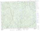
Maps showing Îles du Chevreuil, Lac-Ashuapmushuan; Le Domaine-du-Roy, Quebec
Îles du Chevreuil is a Island located in Lac-Ashuapmushuan; Le Domaine-du-Roy, Quebec.
- Latitude: 48° 8' 53'' North (decimal: 48.1480555)
- Longitude: 72° 51' 32'' West (decimal: -72.8588888)
- Topography Feature Category: Island
- Geographical Feature: Îles / Iles
- Canadian Province/Territory: Quebec
- Location: Lac-Ashuapmushuan; Le Domaine-du-Roy
- Atlas of Canada Locator Map: Îles du Chevreuil
- GPS Coordinate Locator Map: Îles du Chevreuil Lat/Long
Îles du Chevreuil NTS Map Sheets