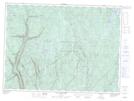
Maps showing Île du Huard, Lac-Croche; La Jacques-Cartier, Quebec
Île du Huard is a Island located in Lac-Croche; La Jacques-Cartier, Quebec.
- Latitude: 47° 17' 54'' North (decimal: 47.2983333)
- Longitude: 71° 27' 10'' West (decimal: -71.4527776)
- Topography Feature Category: Island
- Geographical Feature: Île / Ile
- Canadian Province/Territory: Quebec
- Location: Lac-Croche; La Jacques-Cartier
- Atlas of Canada Locator Map: Île du Huard
- GPS Coordinate Locator Map: Île du Huard Lat/Long
Île du Huard NTS Map Sheets