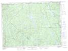
Maps showing Île du Portage, Lac-Jacques-Cartier; La Côte-de-Beaupré, Quebec
Île du Portage is a Island located in Lac-Jacques-Cartier; La Côte-de-Beaupré, Quebec.
- Latitude: 47° 55' 41'' North (decimal: 47.9280555)
- Longitude: 72° 1' 48'' West (decimal: -72.03)
- Topography Feature Category: Island
- Geographical Feature: Île / Ile
- Canadian Province/Territory: Quebec
- Location: Lac-Jacques-Cartier; La Côte-de-Beaupré
- Atlas of Canada Locator Map: Île du Portage
- GPS Coordinate Locator Map: Île du Portage Lat/Long
Île du Portage NTS Map Sheets