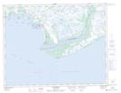
Maps showing Le Grand Goulet, Natashquan; Minganie, Quebec
Le Grand Goulet is a Channel located in Natashquan; Minganie, Quebec.
- Latitude: 50° 6' 58'' North (decimal: 50.1161111)
- Longitude: 61° 48' 56'' West (decimal: -61.8155555)
- Topography Feature Category: Channel
- Geographical Feature: Passe
- Canadian Province/Territory: Quebec
- Location: Natashquan; Minganie
- Atlas of Canada Locator Map: Le Grand Goulet
- GPS Coordinate Locator Map: Le Grand Goulet Lat/Long
Le Grand Goulet NTS Map Sheets