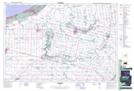
Maps showing Ipperwash Range and Training Area, Lambton, Ontario
Ipperwash Range and Training Area is a Military area located in Lambton, Ontario and has an elevation of 183 meters.
- Latitude: 43° 11' 53'' North (decimal: 43.1980555)
- Longitude: 81° 55' 30'' West (decimal: -81.9250000)
- Topography Feature Category: Military area
- Geographical Feature: C.F.T.A.
- Canadian Province/Territory: Ontario
- Elevation: 183 meters
- Location: Lambton
- Atlas of Canada Locator Map: Ipperwash Range and Training Area
- GPS Coordinate Locator Map: Ipperwash Range and Training Area Lat/Long