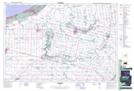
Maps showing Champ de tir et champ de manoeuvre Ipperwash, Lambton, Ontario
Champ de tir et champ de manoeuvre Ipperwash is a Military area located in Lambton, Ontario and has an elevation of 183 meters.
- Latitude: 43° 12' 29'' North (decimal: 43.2080999)
- Longitude: 81° 56' 58'' West (decimal: -81.9493999)
- Topography Feature Category: Military area
- Geographical Feature: C.M.F.C.
- Canadian Province/Territory: Ontario
- Elevation: 183 meters
- Location: Lambton
- Atlas of Canada Locator Map: Champ de tir et champ de manoeuvre Ipperwash
- GPS Coordinate Locator Map: Champ de tir et champ de manoeuvre Ipperwash Lat/Long