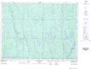
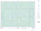
Maps showing Réserve indienne Mattagami 71, Sudbury, Ontario
Réserve indienne Mattagami 71 is a Indian Reserve located in Sudbury, Ontario.
- Latitude: 47° 51' North (decimal: 47.8499999)
- Longitude: 81° 31' West (decimal: -81.5167000)
- Topography Feature Category: Indian Reserve
- Geographical Feature: Réserve indienne
- Canadian Province/Territory: Ontario
- Location: Sudbury
- Atlas of Canada Locator Map: Réserve indienne Mattagami 71
- GPS Coordinate Locator Map: Réserve indienne Mattagami 71 Lat/Long
Réserve indienne Mattagami 71 NTS Map Sheets