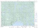
Maps showing Wahnapitei Indian Reserve 11, Sudbury, Ontario
Wahnapitei Indian Reserve 11 is a Indian Reserve located in Sudbury, Ontario and has an elevation of 302 meters.
- Latitude: 46° 47' North (decimal: 46.783333)
- Longitude: 80° 51' West (decimal: -80.8499998)
- Topography Feature Category: Indian Reserve
- Geographical Feature: Indian Reserve
- Canadian Province/Territory: Ontario
- Elevation: 302 meters
- Location: Sudbury
- Atlas of Canada Locator Map: Wahnapitei Indian Reserve 11
- GPS Coordinate Locator Map: Wahnapitei Indian Reserve 11 Lat/Long