Maps showing Réserve indienne Thessalon 12, Algoma, Ontario
Réserve indienne Thessalon 12 is a Indian Reserve located in Algoma, Ontario and has an elevation of 189 meters.
- Latitude: 46° 15' North (decimal: 46.2500000)
- Longitude: 83° 25' West (decimal: -83.4166999)
- Topography Feature Category: Indian Reserve
- Geographical Feature: Réserve indienne
- Canadian Province/Territory: Ontario
- Elevation: 189 meters
- Location: Algoma
- Atlas of Canada Locator Map: Réserve indienne Thessalon 12
- GPS Coordinate Locator Map: Réserve indienne Thessalon 12 Lat/Long
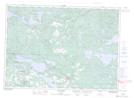
Réserve indienne Thessalon 12 NTS Map Sheets